![](/images/other/stat-length.png)
![Trail Walking Tourouvre au Perche - Tour des Collines du Perche 5 - Photo](https://media.geolcdn.com/t/1900/400/ext.pjpeg?maxdim=2&url=https%3A%2F%2Fstatic1.geolcdn.com%2Fsiteimages%2Fupload%2Ffiles%2F1553511878bg_sport_marche.png)
Tour des Collines du Perche 5
togolo28
User
![Length](/images/other/stat-length.png)
Length
25 km
![Max alt](https://static1.geolcdn.com/siteimages/upload/files/1508320355ic_sort_altitude_max_24dp.png)
Max alt
261 m
![Uphill gradient](https://static1.geolcdn.com/siteimages/upload/files/1508320355ic_sort_den_pos_24dp.png)
Uphill gradient
441 m
![Km-Effort](/images/other/stat-length.png)
Km-Effort
31 km
![Min alt](https://static1.geolcdn.com/siteimages/upload/files/1508320355ic_sort_altitude_min_24dp.png)
Min alt
176 m
![Downhill gradient](https://static1.geolcdn.com/siteimages/upload/files/1508320355ic_sort_den_neg_24dp.png)
Downhill gradient
448 m
![Boucle](https://static1.geolcdn.com/siteimages/upload/files/16400158638029165_repeat_loop_refresh_sync_direction_icon.png)
Boucle
No
Creation date :
2016-10-18 00:00:00.0
Updated on :
2020-09-17 10:15:21.668
![Walking](https://static1.geolcdn.com/sitytour/trail-icons/101.png)
6h43
Difficulty : Medium
![Scan this QR Code to open this trail in the SityTrail application](https://capi.geolives.com/qq0zvz2zws4bq2lad0pu/sitytour/trails/466423/qr.png?size=200)
FREE GPS app for hiking
About
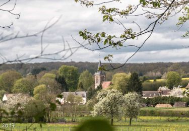
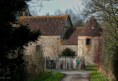
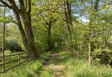
Trail Walking of 25 km to be discovered at Normandy, Orne, Tourouvre au Perche. This trail is proposed by togolo28.
Description
Le Tour des Collines du Perche à été réalisé par l'association « Itinéraires Ruraux » de Pervenchères (orne).
Vous pouvez consulter leur site internet :
http://itinerairesduperche.org
Positioning
Country:
France
Region :
Normandy
Department/Province :
Orne
Municipality :
Tourouvre au Perche
Location:
Unknown
Start:(Dec)
Start:(UTM)
326831 ; 5384594 (31U) N.
Comments
Trails nearby
![Trail Walking Longny les Villages - La Fonte - Malétable 7,8 km - Photo](https://media.geolcdn.com/t/375/260/58715638-860a-4ade-9990-a9918a4f42a8.jpeg&format=jpg&maxdim=2)
![Walking Walking](https://static1.geolcdn.com/sitytour/trail-icons/101.png)
La Fonte - Malétable 7,8 km
Walking
Easy
Longny les Villages,
Normandy,
Orne,
France
![](/images/other/stat-length.png)
7.8 km | 9.2 km-effort
21min
![](https://static1.geolcdn.com/siteimages/upload/files/16400158638029165_repeat_loop_refresh_sync_direction_icon.png)
Yes
![Trail Walking Tourouvre au Perche - [Itinéraire] Parcours de découverte de la Réserve de Bresolettes - Photo](https://media.geolcdn.com/t/375/260/8e304002-6848-4d50-9971-301dd63ddb71.jpg&format=jpg&maxdim=2)
![Walking Walking](https://static1.geolcdn.com/sitytour/trail-icons/101.png)
[Itinéraire] Parcours de découverte de la Réserve de Bresolettes
Walking
Easy
Tourouvre au Perche,
Normandy,
Orne,
France
![](/images/other/stat-length.png)
4.2 km | 4.8 km-effort
1h 5min
![](https://static1.geolcdn.com/siteimages/upload/files/16400158638029165_repeat_loop_refresh_sync_direction_icon.png)
Yes
![Trail Walking L'Hôme-Chamondot - Traversées Percheronnes L'Home-Chamondot - La-Ferté-Vidame 20,4Km - Photo](https://media.geolcdn.com/t/375/260/775b310d-a192-48c6-b723-58a031dc55a1.jpg&format=jpg&maxdim=2)
![Walking Walking](https://static1.geolcdn.com/sitytour/trail-icons/101.png)
Traversées Percheronnes L'Home-Chamondot - La-Ferté-Vidame 20,4Km
Walking
Medium
L'Hôme-Chamondot,
Normandy,
Orne,
France
![](/images/other/stat-length.png)
20 km | 23 km-effort
5h 2min
![](https://static1.geolcdn.com/siteimages/upload/files/16400158638029165_repeat_loop_refresh_sync_direction_icon.png)
No
![Trail Walking L'Hôme-Chamondot - Traversées Percheronnes L'Home-Chamondot - Tourouvre 12,1Km - Photo](https://media.geolcdn.com/t/375/260/304fd560-c33e-465e-bfaa-960f3c968683.jpg&format=jpg&maxdim=2)
![Walking Walking](https://static1.geolcdn.com/sitytour/trail-icons/101.png)
Traversées Percheronnes L'Home-Chamondot - Tourouvre 12,1Km
Walking
Medium
L'Hôme-Chamondot,
Normandy,
Orne,
France
![](/images/other/stat-length.png)
12 km | 14.3 km-effort
3h 10min
![](https://static1.geolcdn.com/siteimages/upload/files/16400158638029165_repeat_loop_refresh_sync_direction_icon.png)
No
![Trail Walking L'Hôme-Chamondot - Traversées Percheronnes L'Home-Chamondot - Monceaux-au-Perche 16,8km PROJET - Photo](https://media.geolcdn.com/t/375/260/e749965e-7201-4a20-b74e-2679c3909745.jpg&format=jpg&maxdim=2)
![Walking Walking](https://static1.geolcdn.com/sitytour/trail-icons/101.png)
Traversées Percheronnes L'Home-Chamondot - Monceaux-au-Perche 16,8km PROJET
Walking
Easy
L'Hôme-Chamondot,
Normandy,
Orne,
France
![](/images/other/stat-length.png)
16.9 km | 20 km-effort
4h 24min
![](https://static1.geolcdn.com/siteimages/upload/files/16400158638029165_repeat_loop_refresh_sync_direction_icon.png)
No
![Trail Walking Tourouvre au Perche - Bubertré - Lignerolles (Boucle) - Photo](https://media.geolcdn.com/t/375/260/ext.jpg?maxdim=2&url=https%3A%2F%2Fstatic1.geolcdn.com%2Fsiteimages%2Fupload%2Ffiles%2F1553511878bg_sport_marche.png)
![Walking Walking](https://static1.geolcdn.com/sitytour/trail-icons/101.png)
Bubertré - Lignerolles (Boucle)
Walking
Easy
(1)
Tourouvre au Perche,
Normandy,
Orne,
France
![](/images/other/stat-length.png)
12.3 km | 15.2 km-effort
3h 0min
![](https://static1.geolcdn.com/siteimages/upload/files/16400158638029165_repeat_loop_refresh_sync_direction_icon.png)
Yes
![Trail Walking Tourouvre au Perche - Bellegarde - Autheuil - Photo](https://media.geolcdn.com/t/375/260/ext.jpg?maxdim=2&url=https%3A%2F%2Fservices.sitytrail.com%2FGeolivesWS%2FDownloadMedia.ashx%3FTrailID%3D111657%26Media%3D7895_1.jpg)
![Walking Walking](https://static1.geolcdn.com/sitytour/trail-icons/101.png)
Bellegarde - Autheuil
Walking
Easy
(1)
Tourouvre au Perche,
Normandy,
Orne,
France
![](/images/other/stat-length.png)
3.8 km | 4.8 km-effort
1h 19min
![](https://static1.geolcdn.com/siteimages/upload/files/16400158638029165_repeat_loop_refresh_sync_direction_icon.png)
Yes
![Trail Mountain bike Tourouvre au Perche - [Itinéraire] Les ruines du château de Gannes - Photo](https://media.geolcdn.com/t/375/260/ext.jpg?maxdim=2&url=https%3A%2F%2Fstatic1.geolcdn.com%2Fsiteimages%2Fupload%2Ffiles%2F1524743154velo.jpg)
![Mountain bike Mountain bike](https://static1.geolcdn.com/sitytour/trail-icons/202.png)
[Itinéraire] Les ruines du château de Gannes
Mountain bike
Difficult
Tourouvre au Perche,
Normandy,
Orne,
France
![](/images/other/stat-length.png)
28 km | 34 km-effort
2h 20min
![](https://static1.geolcdn.com/siteimages/upload/files/16400158638029165_repeat_loop_refresh_sync_direction_icon.png)
Yes
![Trail Car Tourouvre au Perche - 2024-02-24 Perche Trappe V du - Photo](https://media.geolcdn.com/t/375/260/ext.jpg?maxdim=2&url=https%3A%2F%2Fstatic1.geolcdn.com%2Fsiteimages%2Fupload%2Ffiles%2F15247431544x4.jpg)
![Car Car](https://static1.geolcdn.com/sitytour/trail-icons/401.png)
2024-02-24 Perche Trappe V du
Car
Tourouvre au Perche,
Normandy,
Orne,
France
![](/images/other/stat-length.png)
38 km | 45 km-effort
4h 15min
![](https://static1.geolcdn.com/siteimages/upload/files/16400158638029165_repeat_loop_refresh_sync_direction_icon.png)
No